ATLAS
ATLAS
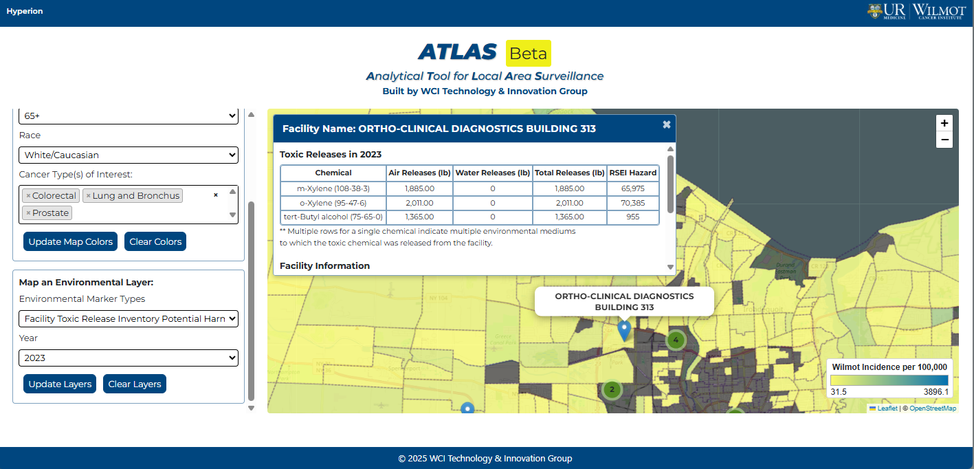
ATLAS is an interactive tool that enables Wilmot Cancer Institute clinicians, researchers, and administrators to map real-time Wilmot oncology data alongside New York State environmental data. Cancer cases are mapped using the Census block groups of patients addresses and can be filtered by patients’ demographic and disease-related characteristics. Additionally, detailed environmental data from several external data sources can be either mapped independently, or layered with Wilmot patient data.
For example, a user could map new Wilmot prostate cancer diagnoses for Black or African American men between 2020 and 2025. On the same map, the user could view pesticide usage data for all NYS ZIP codes.
Features:
- Current Wilmot cancer data filters:
- Patient Sex
- Patient Age at Diagnosis
- Patient Race
- Cancer Type
- Cancer Diagnosis Year
- Current NYS environmental data filters:
- Type of environmental data
- Pesticide usage by NYS Zip Code
- Facility toxic release inventory data
- Air monitor concentration data for NO2 and PM2.5
- Radon measurements by NYS county
- Current external data sources:
- Cornell Cooperative Extension
- Environmental Protection Agency
- Center for Disease Control and Prevention
The motivation for developing ATLAS was to encourage exploration of the relationship between disease and environmental factors.